


Eine der Trainigs- / Probewanderungen – durch das Eschachtal bis zum Staatsbahnhof Trossingen. Wetter bestens, sehr warm. Rucksack mit 12,5 kg vollgepackt. Tourlänge ~: ca. 19 km – Höhenmeter ~: 540 m. Ganz schön anstrengend in der prallen Sonne mit so viel Gewicht unterwegs zu sein 

Start der Wanderung in Bühlingen

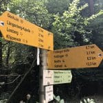
Wegweiser auf der Strecke

Blick ins Eschachtal

-

Entlang am Trauf Richtung Eckhof
-

Schafweide im Eschachtal
-

Schafweide im Eschachtal
-

Weiter auf der Tour. Links hinter den Bäumen die Easchach, ganz vorne links neben dem einzelnen, rundlichen Baum klein zu sehen die Brücke, die wir überqueren mussten.

Weiter auf der Tour

Weiter auf der Tour

Schotterwerk Dauchingen

Abschluss im Staatsbahnhof Trossingen zum Essen

Route der Eschachtal Wanderung
Die zurückgelegte Strecke als Open Street Map Karte mit Höhenprofil und Zusatzinfos:
Map of the route “Probewanderung Eschachtal”: 18.819 m, 542 m of climbing and 481 m of descent, elevation between 585 m and 745 m, time 03:56:57. It starts at 48.14399, 8.62584 and ends at 48.08826, 8.58549 (latitude, longitude).
Maximale Höhe: 745 m
Minimale Höhe: 585 m
Gesamtanstieg: 542 m
Gesamtabstieg: 481 m
Gesamtzeit: 03:57:24